Platform Features
Geosteering Software Features
Model-based and stratigraphic geosteering, survey processing, DrillTracker, WITSML 1.4.1.1 pulls and the GeoEngine AI assistant, in one browser-based platform. Features marked Coming Soon are in development.
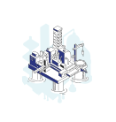
Model-Based Geosteering
Steer to a structural or petrophysical model and update it as the well is drilled, with the model shown against the well trajectory so you steer to it rather than react to it.
Stratigraphic Geosteering with GeoMatch
Correlate LWD responses against a type well and build a GeoMatch interpretation interval by interval, for heterogeneous formations and thin beds where there is no reliable structural model.
GeoEngine AI Assistant
An AI assistant inside each project that answers from your project data: your wells, trajectories and logs, the stratigraphic position of the last survey point, and checks on your GeoMatch interpretation.
DrillTracker
The well against its plan, and the steering ahead: bit projection by trend or hold, bit-to-sensor offset, the steering required to get back on plan, and the plan continuation.
WITSML 1.4.1.1 Connection
Connect a WITSML 1.4.1.1 server, browse its wells and wellbores, and pull trajectories, logs and mudlogs into your project on demand. LAS 2.0 and WITSML file import are also available.
Survey Processing
Trajectories by the minimum curvature method, with dogleg severity, TVD, vertical section and apparent-to-true dip conversion, plus net pay and lag time.
Project Sharing
Invite Named Collaborators who can edit, and Viewers who follow the project read-only. A presence lock stops two sessions editing the same project at once.
LookAhead Prediction
Ahead-of-bit formation prediction from seismic, offset wells and the current trajectory, with probability bands for the next formation top.
GeoEngine
An AI Assistant That Answers From Your Project
GeoEngine works inside each project and answers from your own well data. It prepares changes such as a new GeoMatch or a reference well, and you confirm them; it never edits your interpretation on its own.
- ✓ Answers questions about your wells, trajectories and logs, from your project data
- ✓ Stratigraphic position of the last survey point: which layers it sits between, the trend, and its position against a target you name
- ✓ Validates a GeoMatch interpretation with a score for each interval
- ✓ Prepares a new GeoMatch and opens the form prefilled for you to confirm
- ✓ Lists, compares, saves and restores GeoMatch versions, with your confirmation
- ✓ Reads DrillTracker: the well against its plan and the steering ahead
- ✓ Adds reference wells and imports attached files, prefilled for you to confirm
- ✓ Field intelligence reports about your field from public sources
- ✓ Help from the GeoMaster documentation
- ✓ Slash commands: /position, /validate, /versions, /drilltracker, /wells
In development
- → Automatic GeoMatch refinement
- → Bulk depth shift suggestions
- → Continuous anomaly detection
- → Automatic trajectory suggestions
- → LookAhead ahead-of-bit prediction
Every plan includes a monthly query allowance, starting with 40 on the free plan. A question answered is one query, a field intelligence report is three, and slash commands are free.

WITSML Integration
Pull Well Data From Your WITSML Server
Connect GeoMaster to a WITSML 1.4.1.1 server and pull the objects you need into a project when you need them. Automatic scheduled pulls and WITSML 2.1 are in development.
- ✓ Test the connection, then browse wells and wellbores on the server
- ✓ Pull trajectories, logs and mudlogs on demand, and link them to a project
- ✓ Trajectories recalculated by the minimum curvature method on import
- ✓ WITSML file and LAS 2.0 import for offline or retrospective work
Strat-Based Geosteering
Steer on Stratigraphy With GeoMatch
Where seismic resolution is limited or the structure is uncertain, correlate your LWD responses against a type well and build the interpretation interval by interval as the well is drilled.
- ✓ GeoMatch interpretation built interval by interval against a type well
- ✓ Add reference wells to the project for ambiguous sections
- ✓ Save, compare and restore versions of the interpretation
- ✓ GeoEngine validates the interpretation with a score for each interval
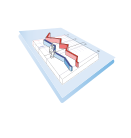
Operational Tools
DrillTracker and LookAhead
DrillTracker is available today. LookAhead is in development.
DrillTracker
The well against its plan, and the steering ahead: bit projection by trend or hold, bit-to-sensor offset, the steering required to get back on plan, and the plan continuation.
LookAhead PredictionComing Soon
Ahead-of-bit formation prediction from seismic, offset wells and the current trajectory, with probability bands for the next formation top.
Share a project with your team or client
Named Collaborators can edit; Viewers follow the project read-only. Sharing is on Pro and Enterprise.
The Platform Layer
The Platform Layer Underneath
Account security and accountability built into the platform, on every plan.
Activity Log & Audit Trail
Know exactly what happened, when, and by whom.
Every action on your GeoMaster account is recorded in your activity log: sign-ins, well operations, AI queries, data imports, billing events, and collaboration changes. Exportable as a CSV on any plan.
- ✓Over 40 tracked event types across 6 categories
- ✓Visible to you at any time from Settings → Activity
- ✓IP address and device logged for every authentication event
- ✓CSV export with full audit trail, ready for compliance review
- ✓Retention: 90 days Free · 1 year Basic and Pro · Unlimited Enterprise
Smart Notifications
Stay informed without being overwhelmed.
GeoMaster's notification system covers every significant platform event, from WITSML imports to payment confirmations, delivered in-app and by email. Every notification type is individually toggleable.
- ✓Over 25 notification types
- ✓Per-type email and in-app toggles
- ✓Security alerts always on: new device logins, password changes
- ✓Bell icon with unread count in the app header
- ✓Priority-coded: critical, warning, info
Session Security
See who's in your account. Act instantly.
GeoMaster gives you full visibility and control over every active session: device, browser, IP, and last activity. Terminate any session remotely with immediate token invalidation.
- ✓Active sessions list with device and IP detail
- ✓One-click session termination: JWT token blacklisted immediately
- ✓All-sessions sign-out for compromised account response
- ✓Login history: last 20 sign-ins with success/fail status
- ✓Project presence lock: only one session per project at a time
Project Presence Lock
No conflicting edits. Ever.
GeoMaster enforces a single-session rule per project. If you have a project open in one browser session, a second session cannot open it simultaneously. This prevents data conflicts in multi-user drilling operations, where two engineers working the same project at the same time could corrupt your geosteering interpretation.
- ✓Edit lock assigned to the first active session
- ✓Blocked sessions shown who holds the lock and since when
- ✓Lock releases automatically on navigation or session end
- ✓Applies across devices: not just multiple browser tabs
- ✓Logged in the activity trail with timestamp and session detail
Try It on Your Own Well
Start on the free plan, or try Pro free for 14 days. No credit card required.